
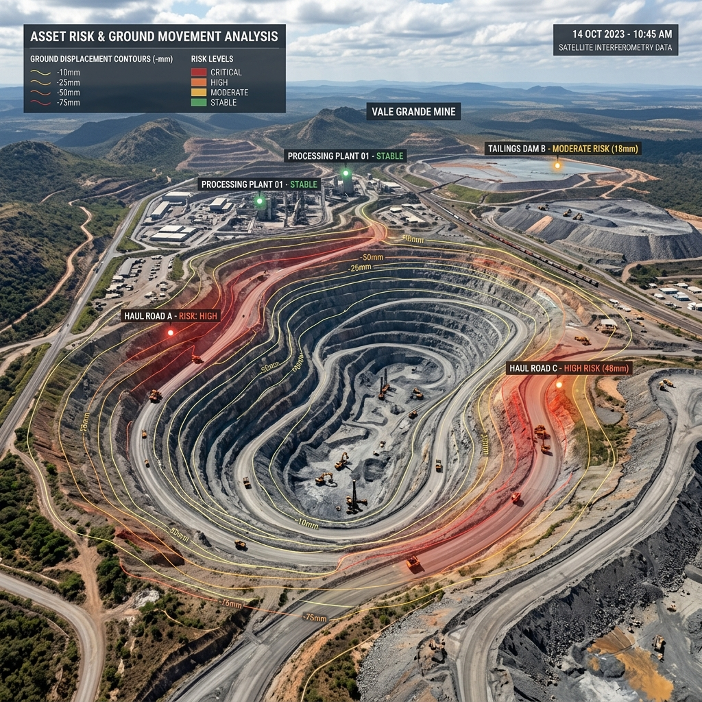
Ground Deformation Monitoring: How Satellite InSAR Is Changing Asset Risk Management
Ground movement is rarely visible when it begins.
A mine slope may experience gradual deformation before instability becomes apparent. A pipeline corridor may undergo slow subsidence. Infrastructure can experience ground movement during or after construction. In urban environments, changes in groundwater levels, excavation, loading and natural geological processes can cause gradual deformation across large areas.
Traditionally, identifying these changes has depended heavily on field surveys and ground-based monitoring systems.
These methods remain important. But they can be difficult to scale across large or geographically dispersed assets.
Satellite-based Interferometric Synthetic Aperture Radar (InSAR) is changing how organisations approach this problem by making it possible to monitor ground deformation across large areas remotely and repeatedly.
What is ground deformation?
Ground deformation refers to changes in the position or shape of the Earth’s surface over time.
It can occur because of:
- Mining and excavation
- Groundwater extraction
- Geological processes
- Construction and tunnelling
- Settlement of soils and foundations
- Underground activity
- Infrastructure loading
- Changes around pipelines and energy assets
The rate and nature of movement can vary significantly. Some deformation occurs over years, while other changes may accelerate over weeks or months.
The challenge is not simply detecting movement.
It is understanding where movement is occurring, how it is changing over time, and whether it warrants further investigation.
How InSAR helps
InSAR uses radar observations acquired by satellites at different points in time. By comparing these observations, specialised processing techniques can identify changes in the distance between the satellite and the Earth’s surface.
Over multiple observations, this can create a time series of surface deformation.
This allows organisations to investigate questions such as:
- Where is ground movement occurring?
- When did the movement begin?
- Is the movement continuing?
- Is it accelerating or stabilising?
- Which areas show the most significant changes?
- Are deformation patterns concentrated around particular assets?
The major advantage is scale.
A single satellite dataset can provide information across extensive areas without requiring physical monitoring equipment to be installed everywhere.
One technology, multiple industries
Ground deformation is not exclusively a mining problem.
Mining
In mining operations, InSAR can support monitoring of:
- Open-pit areas
- Waste dumps
- Tailings facilities
- Slopes and surrounding ground
- Settling areas
Historical deformation data can also provide additional context when investigating areas of concern.
Infrastructure & Construction
Large infrastructure projects can be affected by ground movement during excavation, tunnelling and construction.
InSAR can help monitor deformation around:
- Roads and railways
- Tunnels
- Bridges
- Buildings
- Construction zones
- Other large infrastructure corridors
Oil, Gas & Energy
Energy infrastructure often extends across large geographic areas.
Satellite monitoring can help screen areas around:
- Pipelines
- Production facilities
- Storage infrastructure
- Subsidence-prone areas
- Energy and industrial assets
Urban Development & Smart Cities
At city scale, even relatively slow ground movement can become important when it affects dense infrastructure.
InSAR can support monitoring of:
- Urban subsidence
- Transport corridors
- Construction zones
- Buildings and surrounding areas
- Large-scale development projects
From monitoring to risk management
The value of InSAR isn’t simply the deformation map.
The real value comes from turning deformation information into better decisions.
For an asset owner, this can mean identifying areas that require investigation. For a geotechnical consultant, it can provide an additional source of evidence alongside field measurements and engineering assessments. For an insurer, historical deformation information can contribute to understanding the physical risk associated with an asset. For a lender, it can provide another layer of information during technical or asset-level due diligence.
InSAR does not replace engineering judgement or ground-based monitoring.
Instead, it can act as a large-scale screening and monitoring layer, helping organisations understand where attention may be required.
A shift from reactive to proactive monitoring
One of the most significant advantages of satellite-based monitoring is the ability to observe change over time.
Instead of asking only: “Is there movement today?”
organisations can begin asking: “What has been happening here over the past several months or years?”
That historical perspective can reveal patterns that may not be apparent from a single inspection.
As satellite datasets become more accessible and monitoring workflows become increasingly automated, InSAR has the potential to become an important component of modern asset risk management.
The bigger picture
The future of asset monitoring will not depend on one technology alone.
Field inspections, sensors, engineering assessments and satellite observations each provide different types of information.
The opportunity lies in bringing these sources together.
Satellite InSAR adds a scalable, historical and repeatable perspective on how the ground beneath critical assets is changing.
And for organisations responsible for high-value or high-consequence assets, knowing that change is happening—and identifying where to look—can be the first step towards managing the risk.
InSpective Labs uses satellite-based InSAR to transform ground deformation data into actionable intelligence for critical assets and infrastructure.